Highlights Risk to Indigenous & Farming Communities
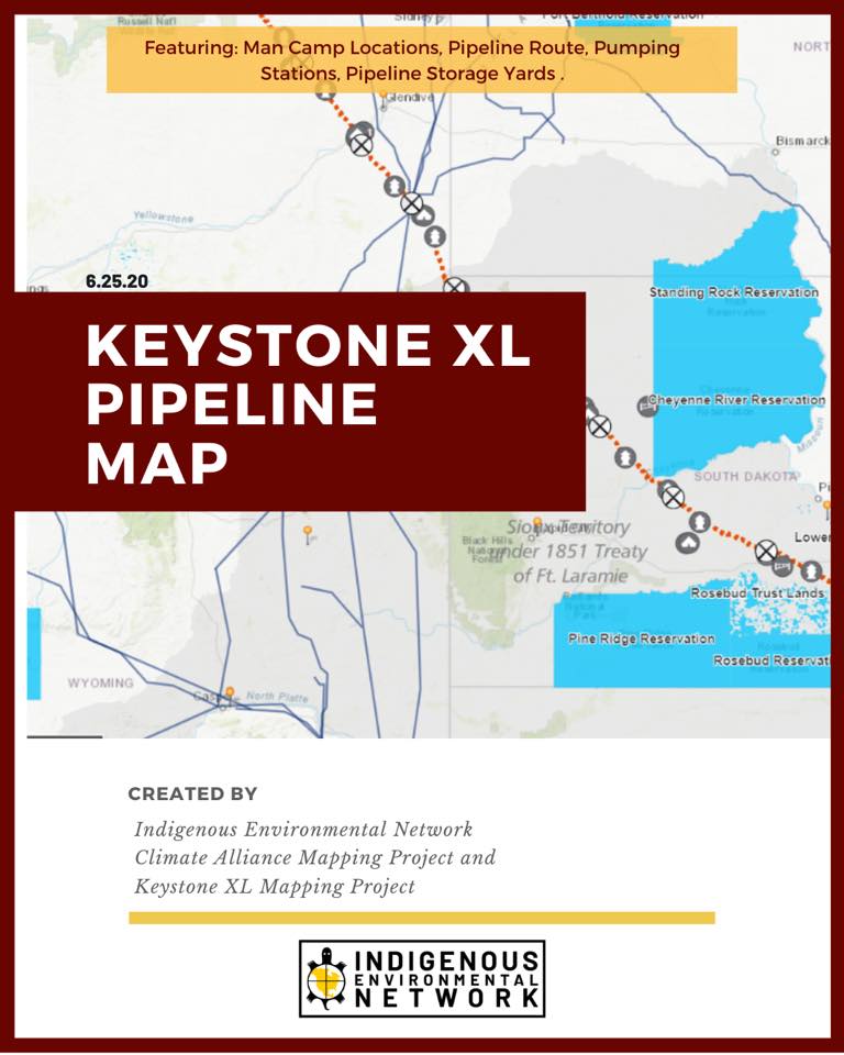 June 25, 2020 (Bemidji, MN) – The Indigenous Environmental Network, in collaboration with the Climate Alliance Mapping Project and the Keystone XL Mapping Project, have just launched the KXL Pipeline Map, an interactive tool that highlights the route of the Keystone XL (KXL) pipeline, a tar sands project of the TC Energy corporation. This map is a free and public tool designed to support impacted communities along the route about the risks of living in proximity to fossil fuel pipelines and development.
On the map users will be able to locate the pipeline route, pumping stations, pipe storage yards, and man camp locations (also known as construction camps). All information was gathered from public documents. The online map can be found here: https://climatealliancemap.org/kxl-map
For over a decade, Indigenous nations and communities have continuously denied consent to the KXL pipeline from crossing their territories, citing environmental concerns, the desecration of sacred sites, treaty rights violations, and the risks of sexual violence connected with man camps.
The following are quotes from the project partners:
Joye Braun, IEN Community Organizer,
“This interactive tool is a powerful visual for Indigenous communities and our allies along the KXL route. Public documents about extractive projects are often difficult to find and hard to read. This mapping tool hopes to bridge that gap by giving communities the ability to see how close this deadly tar sands snake comes to their homes, communities and lands. Between the threat of sexual violence and contraction of the coronoavirus, arrival of KXL construction workers in our homelands poses deadlier risks than ever before and must be stopped.”
Tracey Osborne, Climate Alliance Mapping Project
“Digital maps are a powerful way to educate the public about connections between oil and gas extraction, climate change, social justice, and Indigenous rights. Since 2015, CAMP has worked with Indigenous and environmental organizations to build interactive maps that tell stories about climate justice across the Americas. This map felt particularly timely as construction crews break ground on initial sections of the proposed Keystone XL pipeline. In creating this version of the map, we were grateful to build on the substantial efforts of the Keystone Mapping Project to determine an accurate pipeline route. We hope the Keystone XL Map will add a visual resource that supports the education and advocacy efforts of social movements working for Indigenous sovereignty and a just transition to renewable energy.”